Moisture Update - January 31, 2024
January 2024 was unusual, with a sharp drop in temperatures that started near the beginning of the month, rapidly descending into a bitter cold snap with several stations recording temperatures below -40°C.
The lowest measured temperature was recorded at Keg River AGCM at 51.5°C on January 14, 2024. In comparison, the coldest measured temperature in Alberta (-61.1°C) occurred on January 11, 1911, recorded near Fort Vermillion. The recent cold snap lasted approximately two weeks, and by the end of January temperatures rebounded to near record levels in many areas. The City of Edmonton saw temperatures nearing 12°C, which was close to the record for this area (14°C), measured on January 30, 1931.
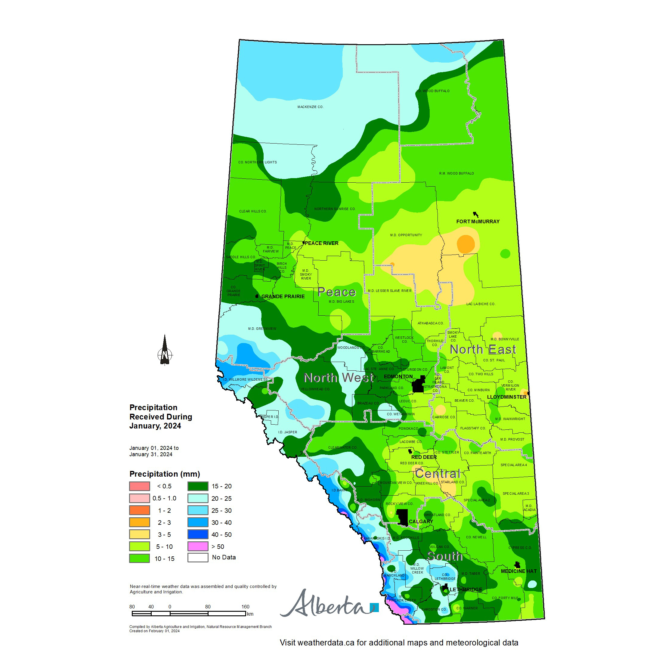
January 2024 Precipitation Accumulations
Thankfully the wild swing in temperatures brought with it some much needed moisture to many areas (Map 1), with three of the four agricultural regions containing lands that received more than 20 mm. Upwards of 50 mm was measured at some of the mountain stations in the southern portions of the province. In contrast, must of the North East and Central Regions, along with a relatively small portion of the Central Peace Region, received lesser amounts, ranging from 5 to 10 mm.
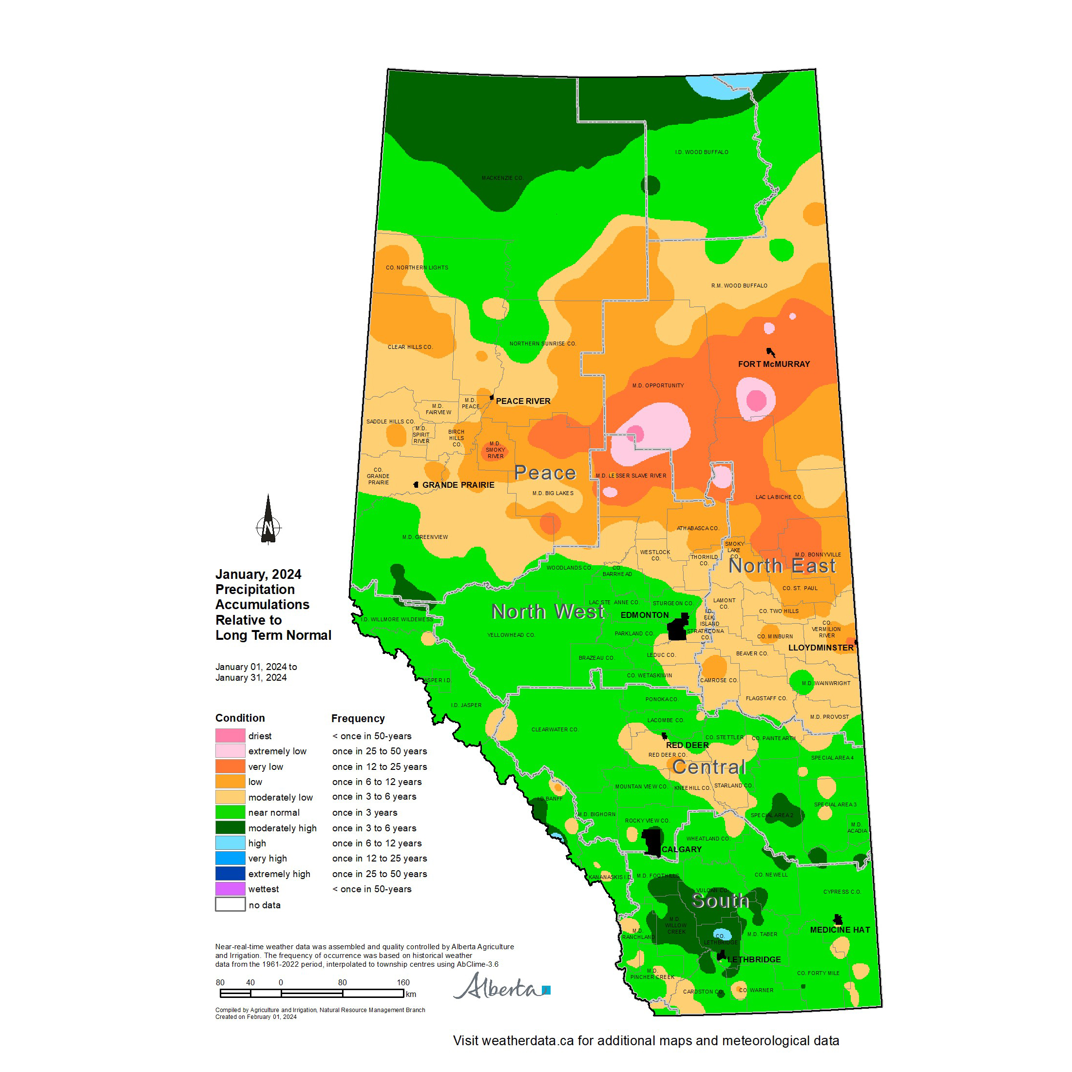
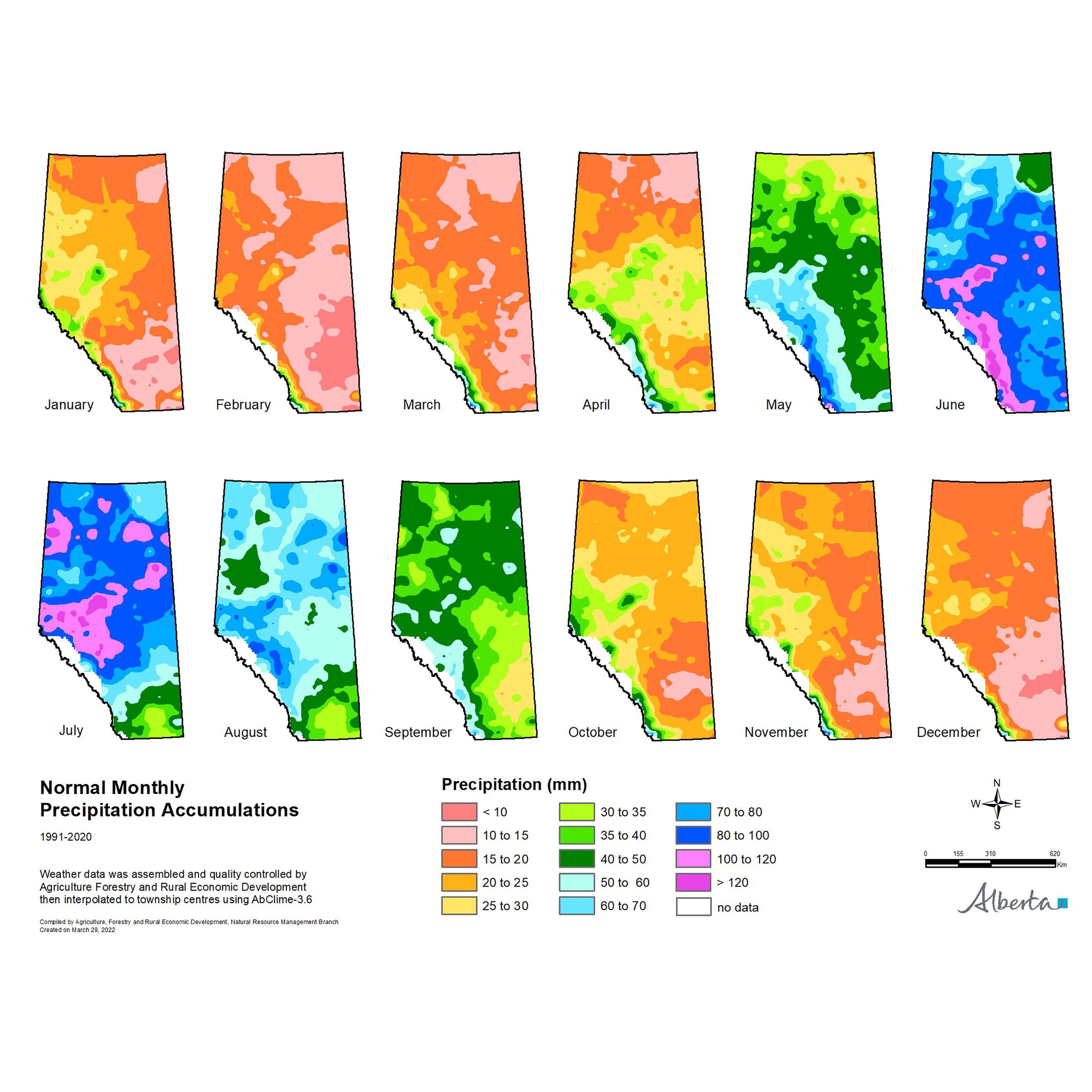
Precipitation accumulations for the month of January were generally near or above normal across much of the Southern and Central Regions and large parts of the North West and Northern Peace Regions (Map 2). Elsewhere accumulations were below normal, however; January is a relatively dry month of the year with average accumulations (1991-2020) of less than 15 mm across the southern half of the province, ranging up to approximately 30 mm across the Peace Region (Map 3).
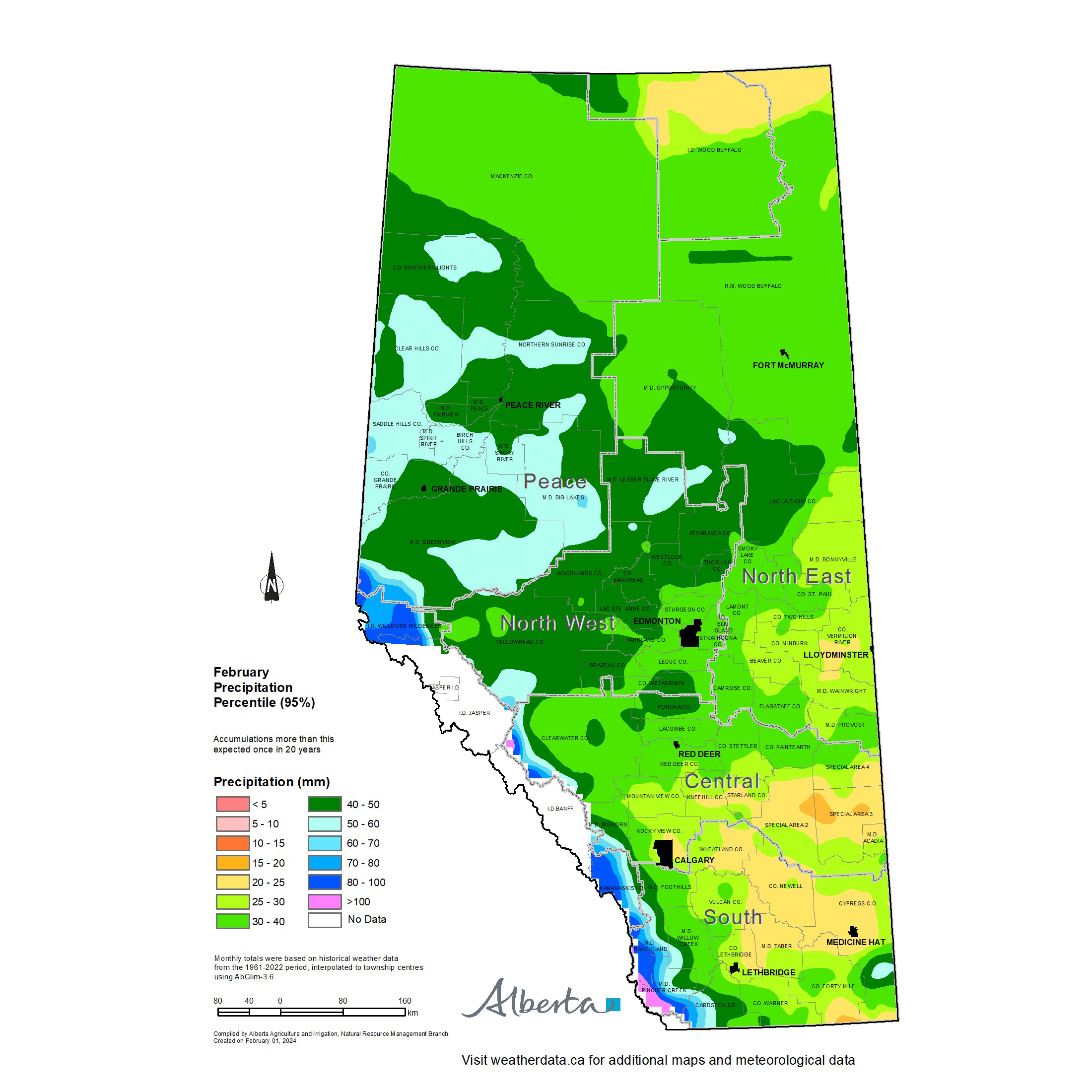
February is historically the driest month of the year (Map 3), so receiving a major shot of moisture now is relatively rare. In fact, based on the period from 1962-2022, only one in every 20 years accumulation will range as high as 20 to 25 mm across the Special Areas, 30 to 40 mm in the western agricultural areas of the province, and 50 to 60 mm throughout the Peace Region (Map 4).
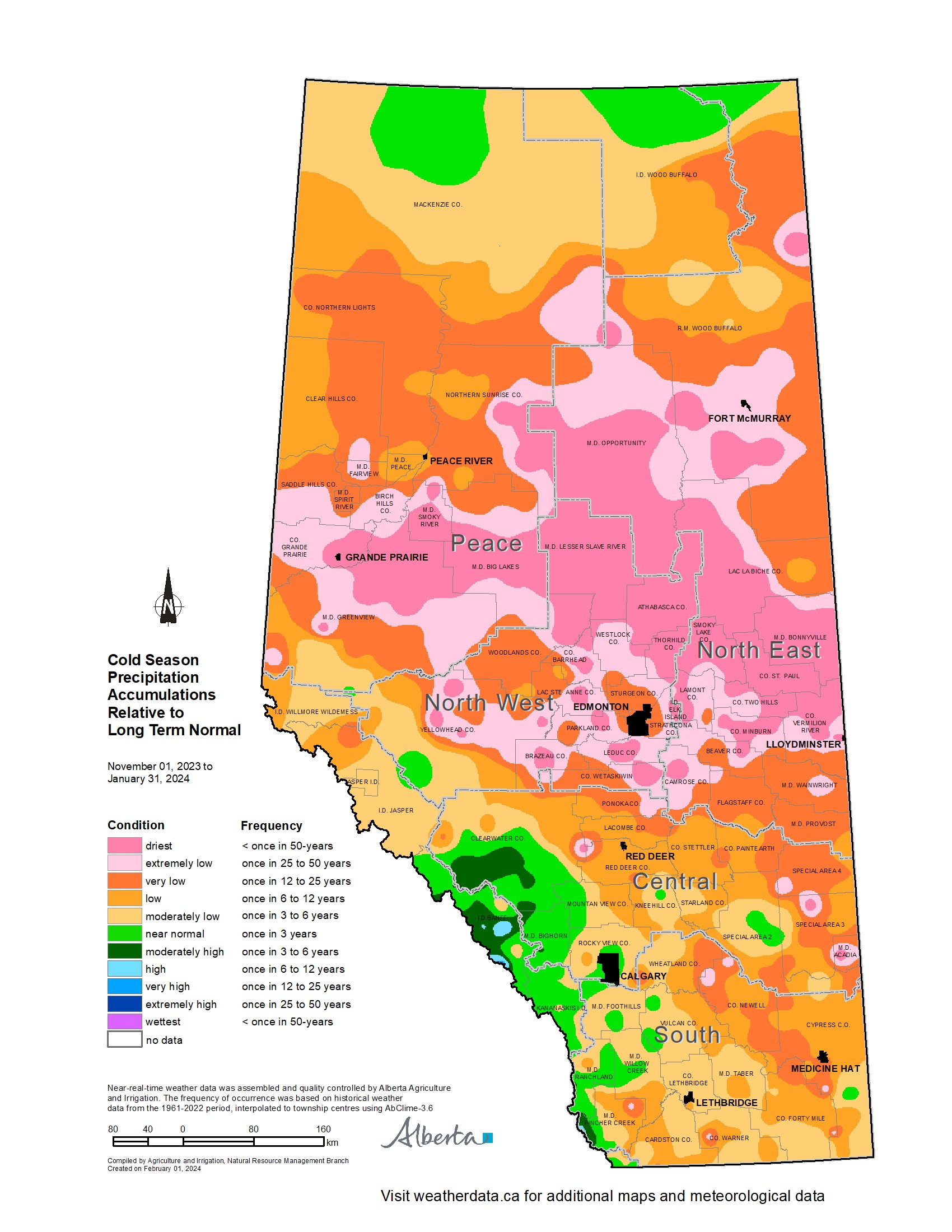
Winter Precipitation Accumulations from November 1, 2023 to January 31, 2024
Since November 1, 2023, the unofficial start of winter in Alberta, precipitation has been well below average across most of Alberta's agricultural regions (Map 5). Large parts of the northern half of the province are estimated to have a winter this dry less than once every 50 years. Dry conditions have also persisted across the Central and Southern Regions, ranging from a few widely scattered pockets of near normal, to close to once every 25 year lows recorded in Jenner, approximately 200 km east of Calgary.
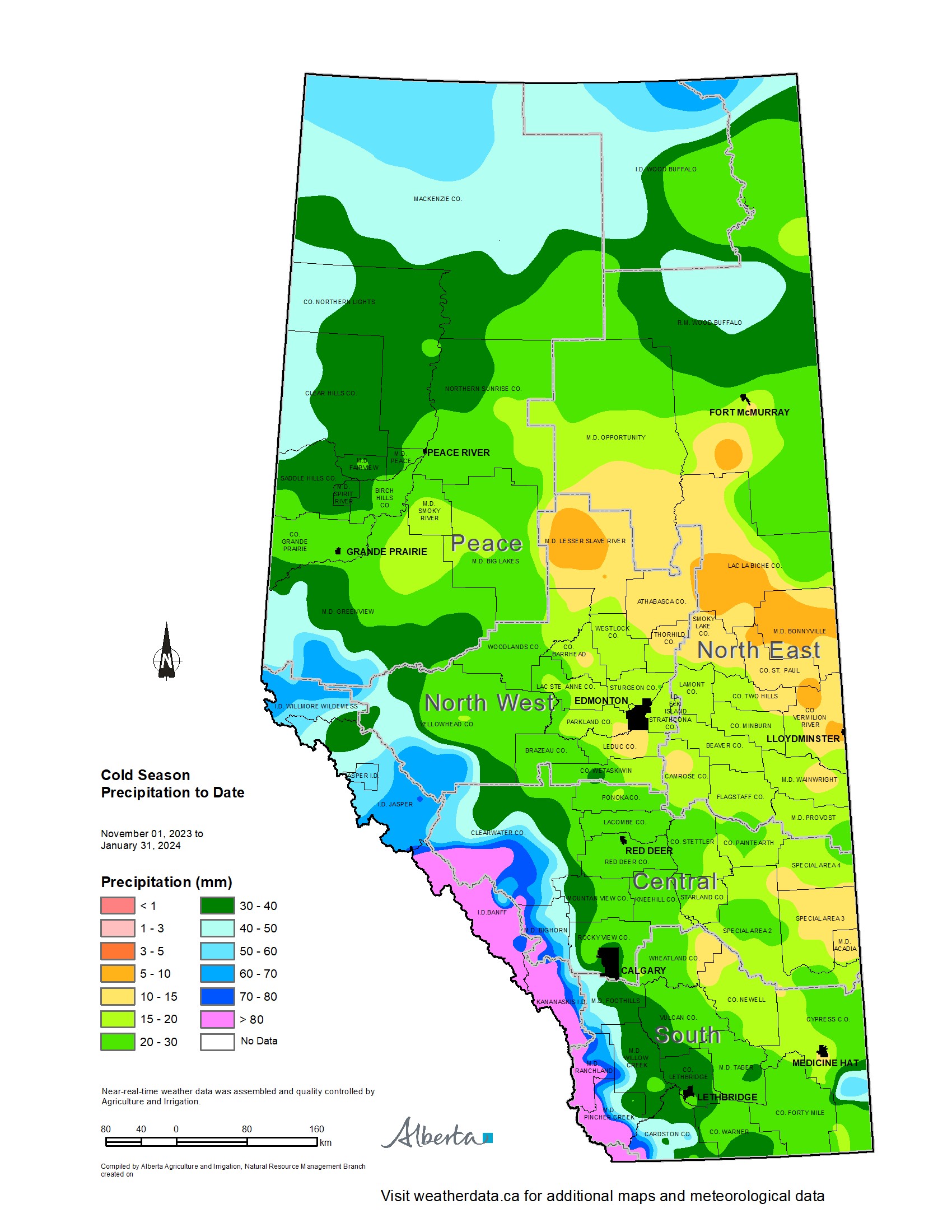
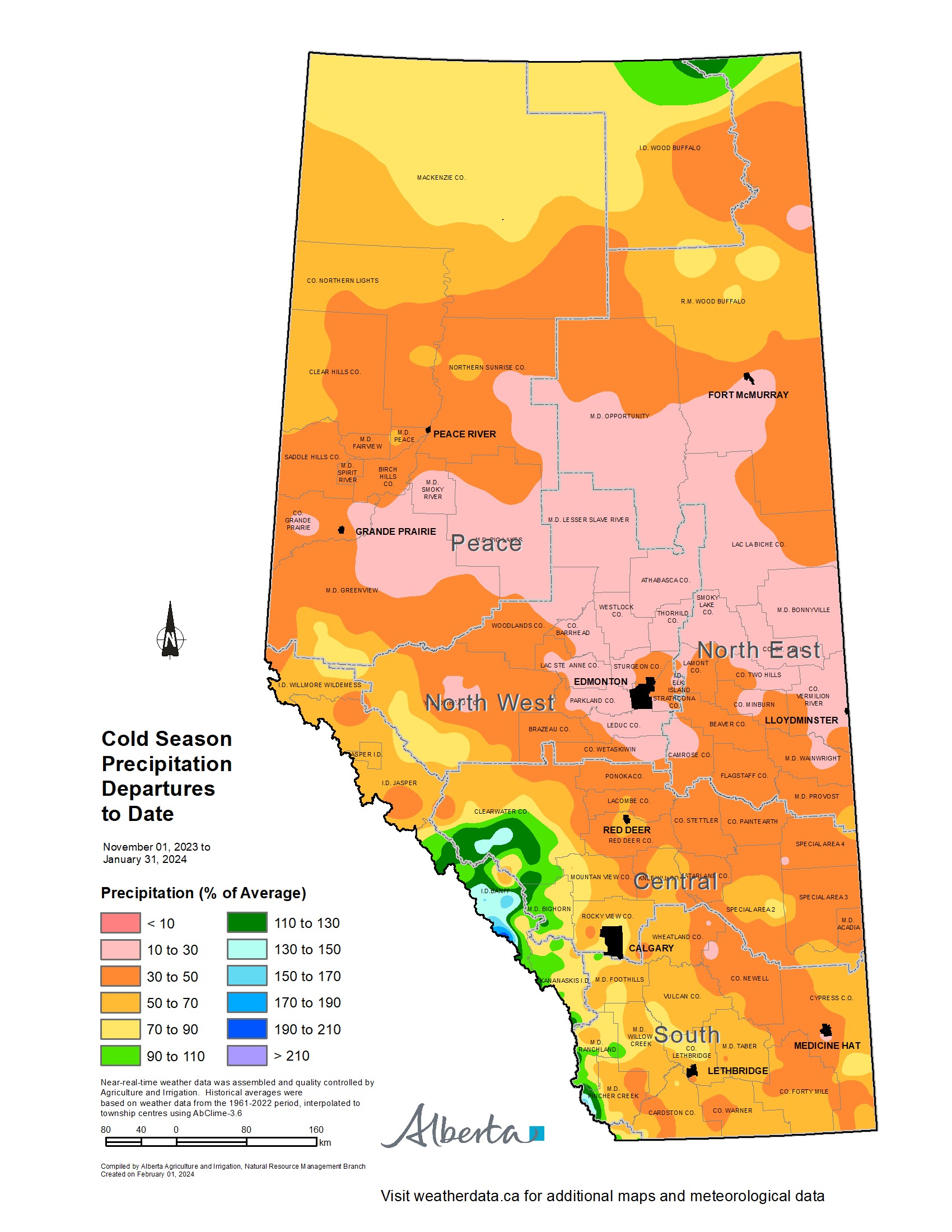
Total accumulations currently range from less than 10 mm through parts of the North East Region, to over 50 mm along the foothills, and 40 to 50 mm through the north and western portions of the Peace Region (Map 6). For the dryer parts of the North West, North East, and Peace Regions this translates to less than 30% of the 1991-2020 average (Map 7).
Perspective
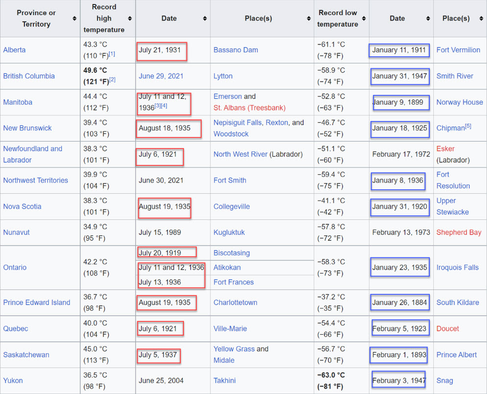
Wild swings in weather patterns are well documented in this meteorological region. Graphic 1 shows the Canadian all-time heat and cold records for each of the provinces and territories. Close examination reveals that 70% of both the heat (red) and cold (blue) records were set prior to 1950, a time beyond most people's living memories. In fact, you would have to be over 110 years old to remember the 27 year period that spanned from 1911 to 1937, when roughly 70% of the all-time Canadian heat records were set, along with a surprising 45% of the cold records. It should also be noted that during this time, the number of meteorological stations measuring extremes were at a fraction of what they are now.
During the winter of 1931, when temperatures reached nearly 14°C on January 30 in Edmonton, the following February remained warm, with only one day where the daytime high failed to break 0°C. That year, the snow packs were at least double of those recorded in mid-January of this year, and yet had melted completely by mid-February. A sudden cold snap in March of 1931, brought nearly 2 ft of fresh snow over a two week period. Winter was back, with daytime highs dropping below -30°C on March 11. The first days of May, saw temperatures touch 35°C, followed by above average moisture in the central parts of the province through June and August (Map 7).
Sign up to our Newsletter
Stay up to date on the Saddle Hills activities, events, programs and operations by subscribing to our eNewsletters.