Skip to main content Skip to footer

A History of the Euro-Canadian Settlement Period

'Historic Elements of Saddle Hills and the Peace River Regional Identity During the Euro-Canadian Settlement Period – 1910 to 1946'

Introduction

The history of Saddle Hills County is inextricably linked with, and in many ways defined by, some of the major historical events and currents which helped shape the larger region of what is described as ‘The Peace River Country.’ It would be impossible to fully understand the history of Saddle Hills County without examining it within the context of those formational forces.

Dr. Robert Irwin, Associate Professor in the Department of History at MacEwan University, published a doctoral thesis in 1995 titled, “The Emergence of Regional Identity: The Peace River Country, 1910-46.” In it he describes the major societal, historical, geographic and environmental forces which contributed to the regional identity of the area during the Euro-Canadian settlement period(s) from 1910 to 1946.

With Dr. Irwin’s permission, we have attempted to summarize his thesis in the hope of adding to a general understanding of how and why Saddle Hills County and the Peace Country are what they are today.

Map Area of Study

The story Dr. Irwin tells provides deep insight into the disparities between what European and Canadian settlers were promised and the realities they encountered when they arrived. He discusses the inconsistency between the broad strokes of settlement policies developed and promoted by federal and provincial layers of government with the functional truths which settlers had to deal with in order to survive.

All of these challenges created a unique identity for a people who often had to read between the lines of what governments were telling them and to develop their own knowledge and understanding of their environment in order to make a living.

Among the major forces Dr. Irwin discusses are:

  • The impact of image-making and boosterism on the expectations of settlers
  • Settlement patterns based on a ‘Laurentian’ view of the country with little understanding of the differences between the southern prairie wheat-growing model of farming and the agricultural realities of conditions in the Peace (soil conditions, muskeg, mixed forest and grassland, climate, precipitation, short growing season)
  • Lack of local opportunities to finance the potential of the region combined with a lack of outside investment which left many of the economic hopes for the area unfulfilled
  • Transportation and communication barriers and the difficulties these posed in getting agricultural and other products out or supplies and people in.
  • Regionalism, demands for provincehood and frustration with outside events and forces which were beyond their control and held so much sway over their economic prospects becoming an integral part of the regional identity of the area

Dr. Irwin often alludes to the strength and resilience of the local population as the different waves of settlement brought new challenges and frustrations and they developed the adaptability which was required in order to survive and prosper under often difficult circumstances. It is arguably one of the most important aspects of the local identity which grew out of the period and some would say continues to characterise the area to this day.

We have published below some excerpts from Dr. Irwin’s thesis which we believe help tell the story of Saddle Hills County, the Peace River Country and the ways in which historical forces have helped to shape the present.

- The full thesis is available through the National Library of Canada or you can view a pdf copy. -

Beginnings

Unjigah. Unchaga. OnL'lego.   All are variations upon the name of the Peace River. Alexander Mackenzie wrote in 1791, "We came to the Peace Point; from which, according to the report of my interpreter, the river derives its name; it was the spot where the Knistineaux (Cree) and Beaver First Nations settled their dispute; the real name of the river and point being that of the land which was the object of contention."

Image of log house from Canadian Encyclopedia

The culture of settlement in the region, however, was rooted in the earlier settlement frontiers. Like other areas of the Canadian west, settlers came from diverse ethnic backgrounds. Each group brought a different perspective to life in the pioneer zone, and different adaptive tactics. Most expected to improve their standard of living, and many sought windfall returns from their adventure. In general they accepted the capitalist, commercial orientation of twentieth century Canadian agriculture.

Moreover, the settlers sought to recreate and improve the society they had left. They created school districts, built country churches, established community clubs, and clamoured for modern transportation and communication services. Like other settlement zones, they resented the metropolitan economy and political system.

Early Agriculture

The suitability of the Peace country for agriculture was the most important aspect of the exploration in the 1870s.

The risk of August frosts in all other locations made wheat farming difficult, and some of the land designated agricultural on maps of the area contained muskegs and heavy timber stands. Agriculture was possible, but dangerous.

Cyrus McCormacks reaper circa. 1831 from study.com

Boosters, promoters, and speculators now took control of the image of the Peace Country. Numerous pamphlets and booklets about the Peace appeared in the period 1907-18, the first settlement period.

The image of the Peace as an agricultural and resource paradise awaiting the daring settler became the dominant theme of local boosterism.

The important questions regarding the suitability of the climate for wheat growing in the Peace River region had never been properly addressed.

The first Euro-Canadians to settle in the countryside drained by the river were the fur traders. A significant change in the pattern of settlement occurred between 1909 and 1911.

Waves of Settlement

The first wave, perhaps better described as a gentle swell, began in 1911 and did not end until 1921; the second, a large powerful breaker, began in 1927 and ended in 1931. Between these two waves of settlement, prospective farmers continued to trickle into the district. Homesteading in the Peace River region, consequently, differed from the pattern in the southern prairies. It did not occur in a single, brief intensive burst of activity. Nor did it occur at a steady pace over the course of a generation. Instead, settlement of the Peace River region was a continuous, on-going, and permanent feature characterised by important waves of activity.

In his work on the Lake Saskatoon and Beaverlodge areas Carl Tracie discovered that early settlers on the grasslands rarely failed.   Those who settled on forest or bush lands, however, had high rates of failure. Since the majority of the settlers in the first settlement wave homesteaded on the open lands, the high ratio of success during this period is reasonable. By 1927, the majority of the open lands had been occupied. This second wave of settlers, therefore, took up homesteads on bush lands reducing their success ratios.

Chart showing Ratio of Applications to Cancellations

Early Farming Conditions

The introduction of Marquis wheat and the early maturing Garnet and Reward wheats also inspired the settlement waves. The development of Marquis wheat had little impact on southern prairie settlement. In the southern prairies, moisture conservation to overcome the semi-arid conditions had to be overcome for successful agriculture.

Summerfallowing, consequently, was a more important development than Marquis. The length of the growing season, however, had become the primary concern about agriculture in the Peace country. Marquis matured up to a week earlier than its predecessor Red Fife, produced a higher yield, yet did not sacrifice any of Red Fife's important milling qualities. The earlier maturity date opened a window for grain growing in the Peace Country. Marquis came into widespread use around 1911 at the same time as settlement began in the Peace region.

Settlements

Image of Historic Dunvegan Settlement from Canadian Encyclopedia

The first agricultural towns in the Peace country were the Dunvegan, Fort Vermilion, and Shaftesbury mission communities. These early settlements offered services such as a flour mill and saw mill to new settlers. Rather than the beginning of a commercial agrarian economy, however, these communities represented an adjunct to the fur trade and traditional aboriginal lifestyles.

The new towns were commercial service centres for the settlement community. Locational problems hence emerged. The earliest potential urban centres in the Peace country were Grouard, Peace River Crossing, and Dunvegan.

These villages (perhaps local centres of population is a better term) often developed from a lone general store and a post office with school district quickly following.

The proportion of immigrants to Canadian-born pioneers slowly decreased from this time onward and, by 1951, nearly 80% of the people in Peace River were Canadian born. The early settlement population was made up of:

  • French
  • Scandinavian
  • Eastern European
  • German
  • British
  • Dutch
  • American

The peculiar and distinctive pattern of an isolated island pattern of settlement and the local concentration of ethnic groups meant that a regional identity did not necessarily pose a threat to their ethnic identity allowing them to retain this within their community, and share in the creation of modern social institutions.

Although the settlement policies of the Dominion were not designed for settlement in the northern forest frontier, the survey and homestead systems used on the southern prairies were extended into the Peace River country, but the typical prairie township described so often in the literature did not exist. The Canadian Pacific Railway, the Hudson's Bay Company, and the Canadian government all played an important role in prairie settlement under this policy.   Each group had a vested interest in settling an agrarian population in Canada. This combination of interests did not exist in the Peace River Country and the Dominion failed to anticipate problems in the area. The pre-emption and purchased homestead regulations applied only in areas where the Dominion understood a settlement problem existed, the dry-lands south of the North Saskatchewan River.

Chart showing Population of Incorporated Settlements


Distinctive Conditions

The land policy failed to acknowledge the distinctive conditions of settlement in the Peace River region and promoted settlement under the same rules as the southern prairies.

The commerce of farming took priority. Settlers desired land which could be brought into cultivation easily; land which they knew was suited to growing wheat. Clearing forest land for agriculture was expensive, time consuming. and delayed the transition from subsistence to commercial agriculture.

Image of Spirit River sttlement from Wikipedia Commons

Some farmers took land in the Spirit River prairie, a small open area focused on the old Hudson's Bay Company ranch and a promising divisional point along the railway.

Other settlers ventured out to Blueberry Mountain or the Pouce Coupe prairie, the third largest prairie, but the most distant from market. These settlers hauled goods and grain by sleigh along the prospective ED & BC rail grade from Spirit River.

As settlement continued through the First World War period, settlers moved into the various islands of occupied lands and expanded them towards the forest fringes.

The areas serviced by the railway, or at least accessible to a railway, became the most important in this period of expansion.  

Image of Blueberry Mountain Settlement Area

Blueberry Mountain settlement area

The Grande Prairie settlement area expanded along all its boundaries slowly pushing settlement in to the willow, aspen, and spruce forest lands west of Lake Saskatoon, along the eastern banks of the Smoky River, and along the southern flank of the Saddle Hills.

Mistaken assumptions by the settlers were certainly a factor in the failure of settlement, but the land policies of the Dominion government and environmental conditions must also been blamed.

Free land and railway building encouraged settlement before it became economically viable and the misallocation of resources resulted.

The conflict between land policy and landscape intensified the economic crisis and led to the failure of many settlers.

Clearing Land & Soil Conditions

In order to clear brush from their land, [farmers] needed money and time. The two, however, were virtually impossible to obtain at the same time. To secure capital, [farmers] had to work off the farm, which reduced the time available to clear land.

Image of early plowing from Wikipedia

Clearing the land proved difficult and often impossible to produce commercial quantities of wheat and oats.  

Besides the problems with the time and cost of breaking forest land, soil quality was an important consideration. Much of this land had poorly drained grey-wooded soils which were unsuitable for grain growing. Farmers often made an effort to clear land only to find it impossible to produce commercial quantities of wheat or oats.

In order to clear land quickly and cheaply, farmers experimented with fire. The fire often scorched the soil, burning the humus, and tended to lead to deterioration of the already poor grey­ wooded soils. Using fire to clear the land resulted in a second major problem for Peace River settlers and as such, wild fires became a fact of life in the Peace River country. Ploughing a fire break around the farm buildings became one of the first projects undertaken on a new farm.

The smaller isolated prairies in the Debolt area on the eastern side of the Smoky River, the Blueberry Mountain region west of Spirit River, the northern and southern sections of the Peace River Block, the Hine's Creek area north-west of Fairview, and especially the Battle River region north of Grimshaw became the focal points of the new expansion.

Isolation

Rolling Hills of Saddle Hills County from U of A

Settlers in the Peace country often found themselves 75 miles from a railway when hauling grain more than 12 miles was considered uneconomic. Under these conditions, little more than a pioneer existence could be achieved.

The isolation which existed in conjunction with scattered settlement resulted in more than social problems. Economically it also created difficulty for bona fide farmers.   In scattered settlement areas the co-operative effort to build roads, operate saw mills and stores, or fight fires became difficult.

Moreover, northern settlement required a battle with the forest and the frosts. An independent farmer struggled to clear a small plot of land, but a small clearing in the forest, he argued, acted like a frost well. Only substantial clearing, ditching, and cultivation of the soil eliminated this problem.

The Lassiter or Wanham Project

Image of historic Wanham from South Peace Regional Archives

Soldier settlement schemes in the area between Spirit River and Falher had the added value of government assisted clearing programs.

Called the Lassiter or Wanham project, this program contracted Lassiter's Limited to clear 100,000 acres of land using brush cutters and caterpillar tractors.

All the Iand was pre-selected for soil quality and designated as soldier's land.

Lassiter or Wanham Project (image of Wanham)

Soldiers could then obtain this land through the provincial lease system with federal financial assistance. Lassiter intended to recover the cost of clearing and breaking the land by collecting one-third of the crop grown for seven years.

The Lassiter project, however, proved to be a failure. The costs of clearing and breaking the land bankrupted the company.

A Wheat Producing Region?

Barley Crop South of Witburn from U of A

The image created by the promotional literature suggested that the Peace Country would become a commercial wheat producing region similar to the southern prairies, and farmers, agricultural scientists, and metropolitan expansionists made a long-term commitment to achieving this goal.

Instead, a limited mixed farm economy developed emphasising wheat, forage, and livestock production with significant intra-regional differentiation.

The failure to achieve their goal prior to 1950, however, did not lead to a sense of pessimism or failure, nor did it reflect a failure to understand and adapt to environmental conditions. The patterns of Peace River agriculture and economy were produced by the combined impact of settlement process, capitalist ethic, imagery and environment.

The prospective settler had little reason to doubt that the Peace River country would be a wheat growing country similar to the southern prairies. The early settlers in the Peace region, however, soon realised that the region had significant environmental limitations for wheat-based agriculture.

Growing Season

The length of the growing season became the most significant climatic consideration for Peace River farmers.   Red Fife, the dominant Canadian wheat variety at the beginning of the century, required approximately 115 days to mature for harvest in the dry southern prairies, and sometimes required 130 days during wet cool years.' A frost-free period of that duration could not be expected in any section of the Peace River region.  

Rainfall

Image of a Saskatchewan wheat farm where the growing season was longer from Wikiwand

Another climatic consideration almost unmentioned in the promotional literature proved significant as well. Just as in the southern prairies, the amount of rainfall received during the growing season caused difficulty for the Peace River agricultural community.

While September rains are not unusual for most of the arable area in Alberta, when combined with the short growing season, the fall rains proved to be a significant problem in the Peace country. Seeding usually occurred in early May, and thus cutting could, at the earliest, occur in late August and threshing in September. The fall rains resulted in a further delay in harvest until the mid-October period with the increased risk of frost damage and the frequent problems of bleaching grain.

Frosts and or snow during June, July, or August damaged the crops in extensive sections of the Peace River country in 1916, 1918, 1926, 1933, 1935, and 1937. Indeed, Albright noted that harvesting was completed in the snow, often as late as December, in the early settlement years of 1913, 1916, 1919, and 1920.

Soil Conditions

Whjeat Field near Bonanza from U of A

Three main soil types existed in the Peace River region. In the prairie sections, most notably the Grande Prairie, the Fairview/Berwyn prairie, and the Spirit River prairie, transitional or degraded Black soils predominated. These soils contained high nutrient value and represented the best soils in the region. Surrounding these prairie areas, the land covered in light brush and scrub consisted of Grey-Wooded Transitional soils.

This land had a thinner layer of top-soil and a lower nutrient content. The remainder of the land in the Peace River country, nearly 80% of the total area, had Grey-Wooded soils. Formed under the forest, these soils had a thin top-soil, lacked nutrients, notably nitrogen, and, because they were formed from decaying pine needles and leaves, were acidic. Although many of the soil management techniques used in southern agriculture could be adapted to the degraded Black soil zone. new methods would be needed to farm the grey-wooded soils. Few farmers understood this problem.

Water

Spring run off near Gordondale from U of A

Farmers on the Spirit River prairie and others had significant difficulty obtaining an adequate water supply. The streams and creeks in these areas run in deep gorges making easy access for water collection difficult. The run-off, furthermore, was variable and unpredictable for damming and storage. Dug and bored wells could not reach adequate depth to obtain a water supply.  Only drilled wells of 400-600 feet or more reached a useable, though often undrinkable, water source.

Successful farming depended upon the willingness and ability of farmers to adjust their perceptions to the conditions.

The northern environment, the distance from the metropolitan market, the Depression, and the settlement process. all restricted the development of commercial agriculture. As a result, the agricultural economy in the Peace River country maintained several elements of a pioneer region, and the boosterism and speculation which characterised the pioneer stage never died.

Speculation

Next to agriculture, speculation was the most important economic activity in the Peace River region. The unscrupulous urban speculation at Dunvegan and Grouard has been documented on several occasions.

The Dunvegan land boom of 1913-14 is a classic speculative adventure. Dunvegan was advertised as the "city of the north" with paved streets, bridges and steamboats plying the river. In reality, Dunvegan consisted of a few buildings in the valley flanked by the steep hills.

Roads

Image of wagons on early road in Saddle Hills County from South Peace Regional Archives

(Image) Settlers arriving in the Blueberry area

Road construction had emerged as an issue following the Great War.

The depth of the valleys of the Peace River, its tributaries, and the numerous creeks which carved their way down to meet the river, however, made road building in the Peace River region expensive.

Road issues dominated local meetings in many settlements. Settlers expressed concern about the inability to market grain and demanded assistance. 

Some settlers took matters into their own hands. The Braden brothers, for instance, constructed a crossing of the Pouce Coupe river in 1923 to improve access between Spirit River and Rolla.

Forestry

Despite promising surveys, the forest industry in the Peace River region consisted of small scale saw and planing mills utilising farmers as a labour source. The activity of the Grand Trunk Pacific contractors Foley, Welsh and Stewart caused some problems. This firm held most of the good timber reserves surrounding the Grande Prairie. Although rumours of a pulp mill circulated the district. they made few moves to develop this resource. Forestry, consequently. remained an un-realised resource for the regional community.

Oil & Gas

Alberta pipeline circa 1923 from About Pipelines

Oil & Gas exploration peaked in 1919-1920

Petroleum activity was very different. Exploration work dominated the speculative business enterprises in the early settlement period. The possibility of oil production from the Athabasca and Peace River country had been debated for years.

Speculation and oil fever hit the community of Peace River in 1918 and speculation continued unabated into the 1920s. At its peak in the winter of 1919-1920, seven companies actually participated in the Peace River oil bonanza. The next year, oil field mania spread to the south Peace following rumours that Imperial Oil would drill in the Pouce Coupe district.

Image of Oil Exploration in Saddle Hills County from U of A

Oil field mania soon died in Peace River. Reports of drilling operations in the valley surfaced occasionally in the local press into the 1930s, and the local community continued to promote activity, even demand activity, through World War Two. Small scale projects kept the dream of oil wealth alive in the community.

A gas well at Bonanza was finally brought into production in the fall of 1943.

Despite the efforts of the Peace River boosters, the regional economy -- agrarian, merchant and speculative -- remained at a pioneer level through World War Two.

Unfulfilled Potential

Although the economy demonstrated weakness overall, the landscape offered the residents a potential source of wealth in wheat, livestock, oil, coal, and timber.

The residents had to wait, however. The economy had not yet fulfilled the promise of the image. Some people certainly gave up on the region in disillusion and despair. For those who remained, a quest to fulfill the image dominated their lives.   They recognised the need to adapt to the landscape and to exploit its wealth, but they came to believe that the Dominion and Provincial governments had failed to comprehend it. Transportation concerns soon dominated their relationship with the metropolitan communities. Improved transportation, they firmly believed, would fulfill their dreams.

Roads & Railways

Few issues could excite the Peace River communities like roads and meetings were often marked by chaos.

Northern Alberta Railway Peace River 1919-1921  from Historic Places.ca

The arrival of a railway in the Peace River region in 1914 reduced the reliance of the district on trails and roads, but the demands for improvements of these projects did not disappear.

When completed the railway played only a minor role in intra-regional traffic. Roads and trails were the main avenue for intra-regional traffic.

Roads also held a certain mythical importance for the settlers in the Peace River region. Although less than useful as a mode of transportation for commodities prior to the Second World War, roads were a symbol of progress and modernity. Thus, demands for a system of roads connecting the disparate districts of the Peace River region with Edmonton continued.

By 1924, a single road wound through the Peace River country connecting most of the settled districts. It began as a trail at High Prairie in the southeast corner and proceeded north to Peace River. At this point it crossed the Peace River valley and became a graded earthen road west to Waterhole and Dunvegan. At Dunvegan, the graded road crossed back to the south side of the river by ferry and moved south to Spirit River. The route from Spirit River to Grande Prairie became a trail once again through the Saddle Hills.

Image of Grouard-Peace River Trail early 1900s Glenbow archives

It remained the main route in the countryside throughout the period of study. The condition of the road became the most pressing concern for the region.

Complaints about the washouts, muskegs, and mudholes existed from the outset. Slowly, a desire emerged to gravel the road and make it passable to motor vehicles in all weather. Despite the efforts of Alberta to meet this demand before the Second World War the road remained primarily a poorly graded, rutted, earthen road. The quest for modernity and progress remained unfulfilled.

Poor Financial Underpinning of Railway System

The poor financial underpinning of the [rail] line would plague the Peace River rail system throughout its existence.

When service was available, the trip from Grande Prairie to Edmonton averaged 37 hours and trains often travelled little faster than passengers could run. Had service been maintained, these conditions might have been tolerated by the Peace River residents. During the summer of 1919, however, the rail bed between Spirit River and Grande Prairie had become unusable. During the winter, when the rail bed froze, train service continued but a shortage of rolling stock could not move the Peace River harvest out of the region nor supplies into the area.


Settlement Poster for Canada West

          'Boosterism'

Boosterism is a philosophy often used to determine historical patterns in urban settings. Its foremost student in Canada is Alan Artibise.' Artibise describes boosterism as a philosophy which at its heart has the concept of growth. Boosterism, and the boosters themselves, linked the idea of better with the term bigger.

These prairie urban elites built a sense of community spirit which bridged the economic and social gaps within their cities.

They promoted the notion that all classes and groups were united on the basis of faith in the city, belief in its destiny, and commitment to its growth.  

This community spirit thus found itself based more on myth than on reality. The promotion of various cities by their boosters led to inter-urban competition, resentment, and regionalism.

Own Your Own Home Canada West

          'Regionalism'

Despite the intra-regional divisions on the railway and highway projects, the apathy of the metropolitan community and its ignorance of conditions in the region as demonstrated in the provincial government's lack of commitment upon the transportation issues was a motivating factor for Peace River regionalism.

Peace River regionalism reflects perceived underdevelopment, an appreciation of regional distinctiveness, awareness of environmental adaptation, and faith in the future potential of the landscape.


Disinterest in Northern Affairs

The misunderstanding of Peace River problems by the provincial governments extended beyond the transportation issues. All districts in the Peace River Country blamed the provinces for a failure to recognise the distinctive regional requirements of their home. The antagonism between the Peace Country and the provincial administrations in Alberta and British Columbia had a long history of discontent. Following the first settlement wave, the Alberta government had demonstrated little concern over the welfare of northern farmers. It encouraged farmers to purchase livestock after the great war with low interest loans, but offered no assistance as cattle prices dropped and feed shortages occurred.

The most important issues were the problems of homesteading in the bush, obtaining sufficient water, relief for new settlers, and provincial enforcement of game laws. All of the districts had to contend with the difficult process of fighting back the forest and creating a homestead within the bush. The repeated calls for provincial assistance, however, went unanswered. Similarly, the provincial governments provided no assistance to those facing the problem of poor water supplies and seemed oblivious to the specific relief problems caused by Depression settlement in the region.

Virtue Out of Necessity?

Life in the Peace River district had not been easy for the agricultural pioneers. Mary Percy Jackson commented:

Image of men in town likely Spirit River - from South Peace Regional Archives

“You know I'd never recommend anyone to homestead in Canada. Farming out here is just as uncertain as anywhere else, and this homestead entry, with a unit of 160 acres, practically forces men into growing grain, which is notoriously the biggest gamble of all. There are a good many families up here now who are a good deal nearer to starvation than any I've ever seen in England. And as for the housing conditions - well - two families (6-10 people) living in a one-roomed house 10 x 12 x 7 is not even considered overcrowding.”

Rather than give up in despair, the Peace River settlers made a virtue of their struggle and continued to emphasise the richness of the land.

The boosters continued to promote the mythical Peace River rather than the stark reality they faced. "Extremes of temperature, sudden changes and severe storms are very rare," one pamphlet suggested. "The winters, while not classified as mild, are very dry, with clear skies, little snowfall, and few winds. Blizzards are unknown!"    All accepted that the struggle to overcome the landscape generated a distinctive pioneer mentality amongst the Peace Country settlers.

The regional unity, nevertheless, was partly an illusion.  While the common struggle to create a farm from the landscape united the community, the landscape also divided the region.

Conclusion

The Peace River thus encompassed the three elements of Peace River regional identity: imagery; environment; and pioneer-hinterland culture.

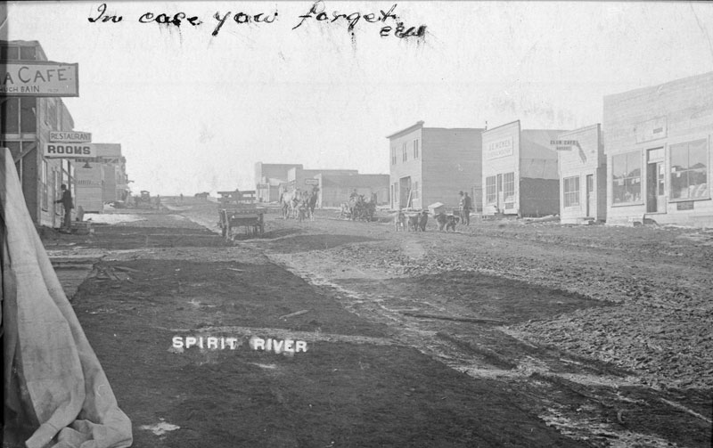
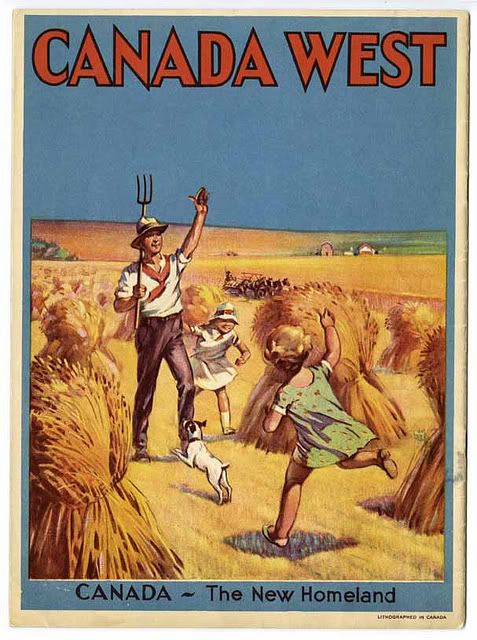
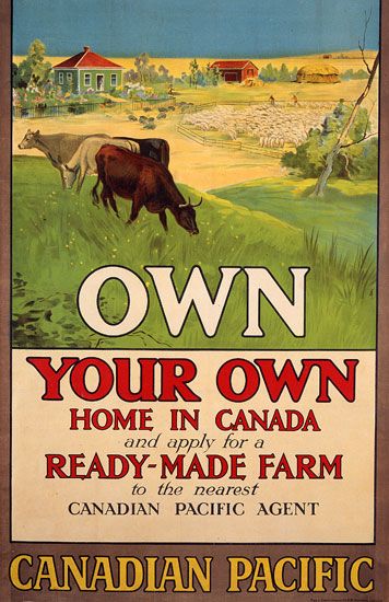
The imagined region created by the southern booster community included both aesthetic and utilitarian qualities. The reports by railway surveyors, the Geological Survey of Canada, Dominion Lands surveyors, and Peace River boosters and speculators all provided spectacular descriptions and vivid portraits of the Peace River valley and the parkland plateaux so unexpected at fifty-five degrees north latitude. Their true purpose, however, was to create an image of the Peace River region as a potentially wealthy agricultural frontier.   To this end, the reports suggested that 20 million acres of fertile land existed in the region, that the climate was suitable for wheat growing, and that the majority of the Peace River region consisted of open parkland prairies. The imagined region, consequently, consisted of a thriving agricultural community living in a splendid, overpowering, eden-like landscape.

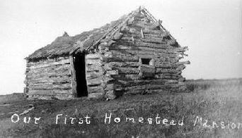
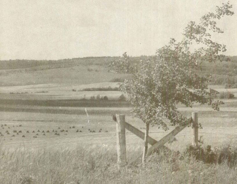
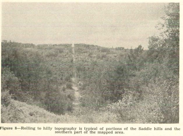
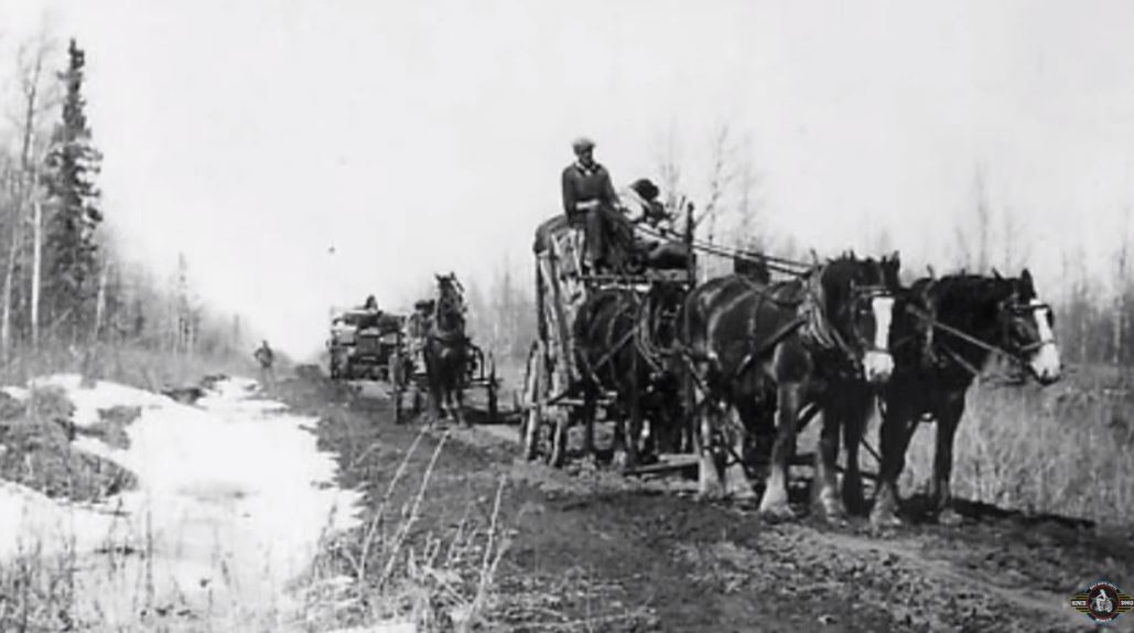
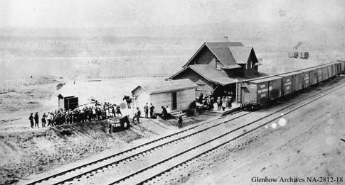
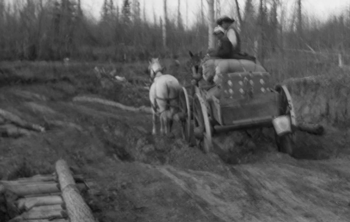
The Peace River environment did not fit the image which had been created. Thick forest, a short growing season, and variable soils all greeted the settlers. Early settlers concentrated upon the open grasslands of the prairies, and as a result, isolated islands of settlement emerged in the region. Between these disconnected islands, vast stretches of aspen, willow, and spruce forest interfered with the settlement process. Few farmers could carve out a commercially viable farm in these districts without assistance.

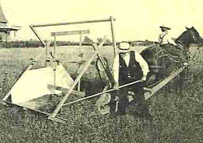
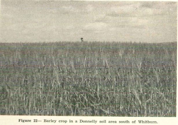
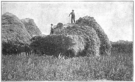
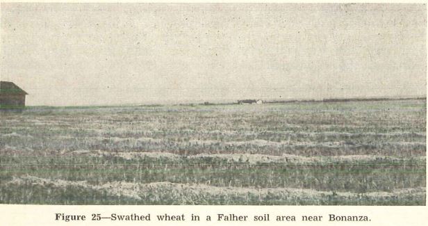
The new farm community soon learned that successful agricultural production also required adaptation to the new environment. Early pioneers had practised a subsistence based mixed-farm system, but the settlement community planned to create a commercial economy based upon ranching and wheat production. Limited water supplies and the long winter feeding period, in many districts, however, made ranching uneconomic, and traditional wheat varieties such as Marquis regularly failed to mature in the region.

The long process of adaptation to the environment resulted in an enduring pioneer quality in the Peace River region.

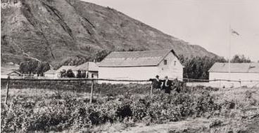
The regional identity remained speculative and booster oriented.   They sought windfall economic opportunities, and, in an effort to overcome the pioneer perspective, boosters emphasised the symbols of a modern society such as schools, hospitals, libraries, drama and music festivals, and sporting events.

By Exploring image making, settlement, agriculture, economy, transportation and communication, and regionalism, it has introduced the key components of the regional identity complex.

These included:

  • The spectacular beauty of the river valley and the parkland prairies
  • The potential prosperity that awaited the successful pioneer
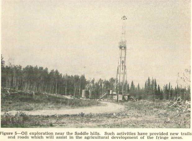
  • The untapped resource potential which awaited the speculator
  • The struggle against the landscape as they attempted to carve out a farm in the region
  • The constant adaptation of agricultural practice and technique
  • The isolation and the long struggle to create the proper and just transportation system
  • The metropolitan-hinterland relationship.

All of these points formed a part of the regional layer of identity.


While this edited version of Dr. Irwin’s thesis must, of necessity fall seriously short of doing it credit, with his help and support we have chosen passages which we hope can provide a brief but succinct summary of his work especially as it relates to the Saddle Hills County. Among the important sections of his work that we have omitted is a section on the movement to fight for provincehood for the Peace River area which can be viewed in the original.


Charts & Maps


Images

Contact Us

Saddle Hills
Junction of Hwy 49 & Secondary Hwy 725
RR1, Spirit River AB
T0H 3G0
T. 780-864-3760
Fax 780-864-3904
Toll-free 1-888-864-3760
frontdesk@saddlehills.ab.ca

Sign up to our Newsletter

Stay up to date on the Saddle Hills activities, events, programs and operations by subscribing to our eNewsletters.

This website uses cookies to enhance usability and provide you with a more personal experience. By using this website, you agree to our use of cookies as explained in our Privacy Policy.