Moisture Update - January 3, 2024
Synopsis
This year’s El Niño has been strong, and currently has a 54% chance of developing into a “historically strong” event, according to NOAA. Current forecasts are projecting El Niño to diminish in April 2024. In the past for Alberta, not all El Niño’s have resulted in warmer and drier weather. However, this unusually warm and dry winter will forever be tied to the 2023-2024 El Niño and will serve as an important data point in the future.
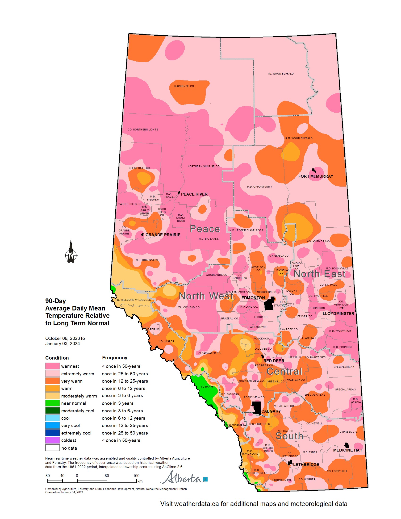
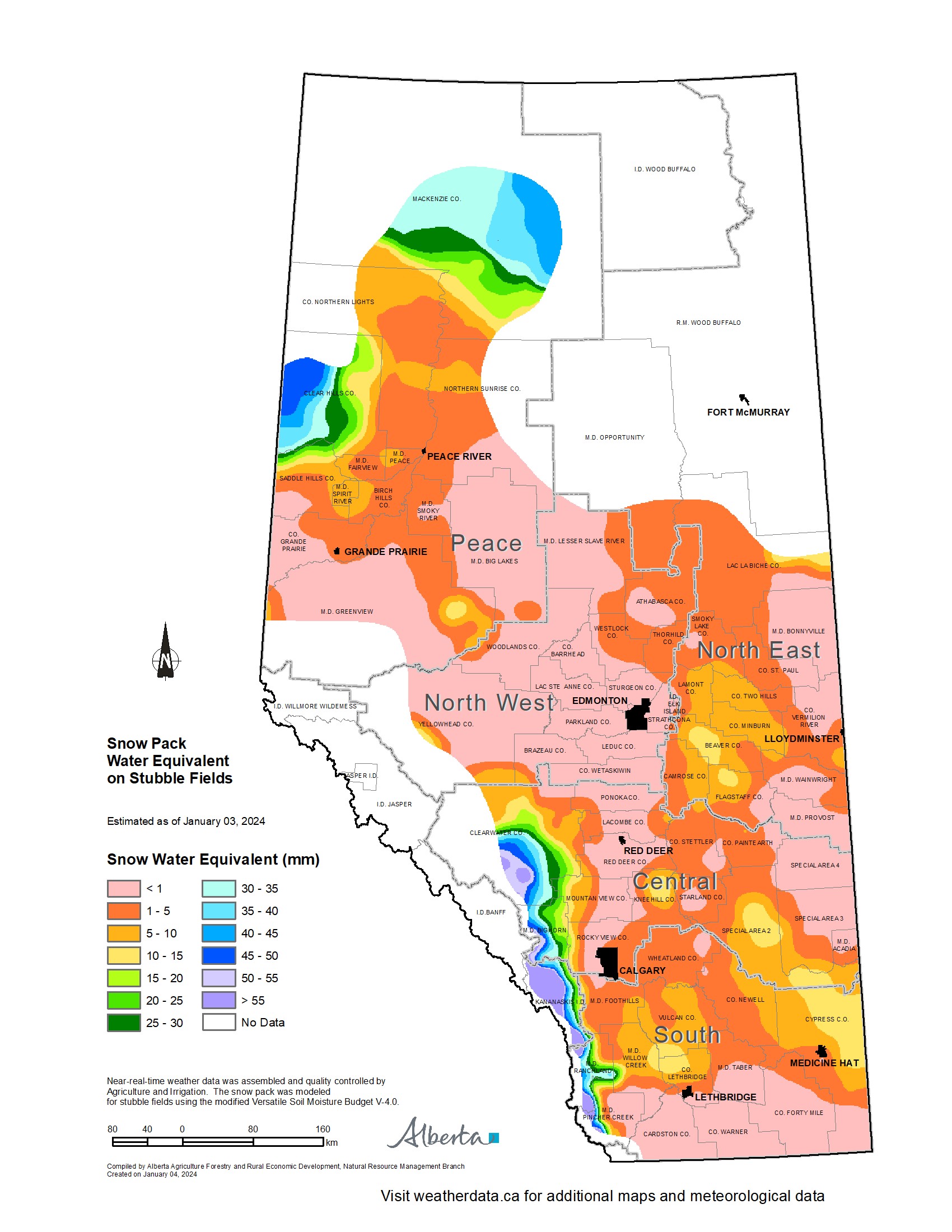
In the 90-days since October 6, 2023, temperatures have remained well above average, with many parts of the northern-half of the province only seeing temperatures this warm less than once in 50 years (Map 1). This, coupled with low precipitation accumulations, has resulted in virtually snow-free conditions across parts of all four of our agricultural regions (Map 2).
Winter Precipitation Accumulations from November 1, 2023 to January 3, 2024
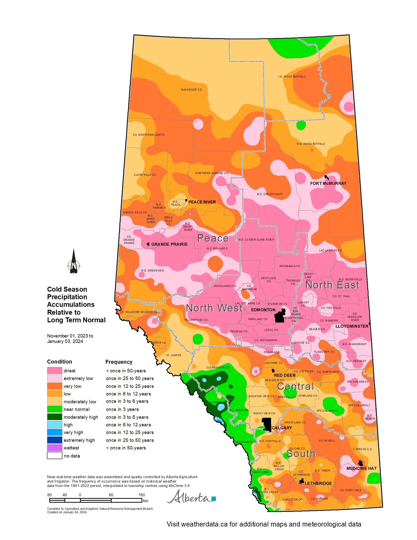
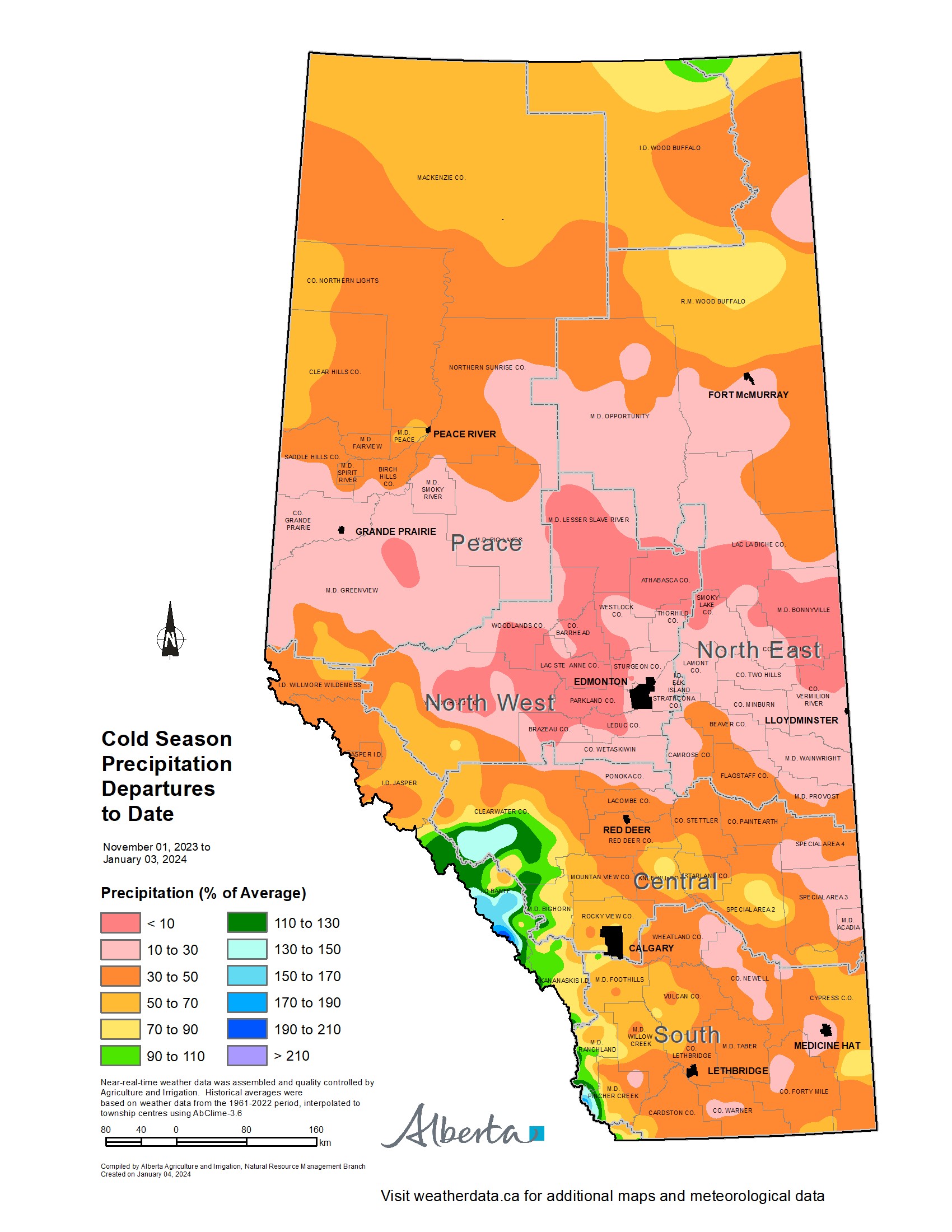
Since November 1, 2023, the unofficial start to winter in Alberta, precipitation has been well below average across many of Alberta’s agricultural areas (Map 3).
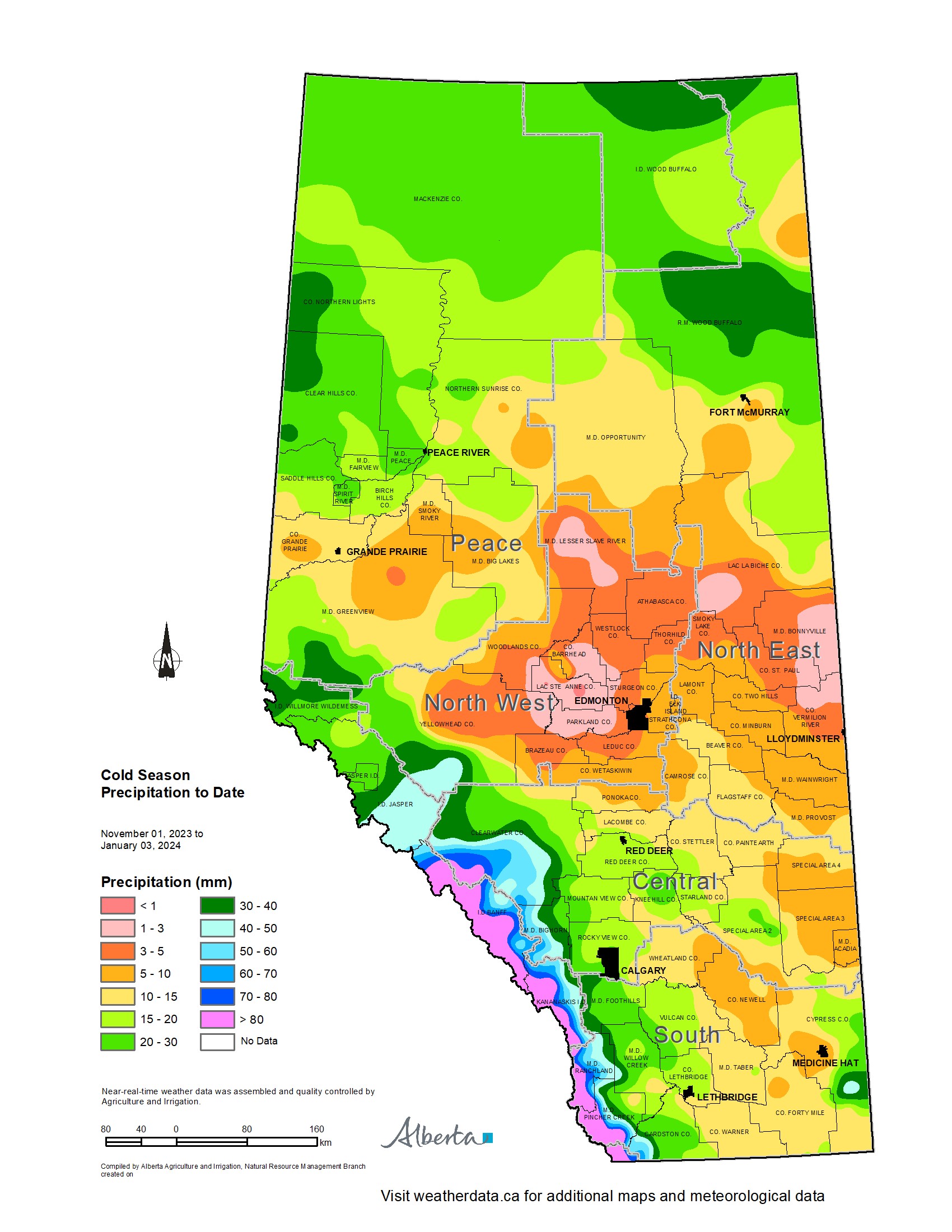
Most of the lands south of Grande Prairie and north of Ponoka, are estimated to have a winter that is (thus far) this dry on average less than once every 50-years. Dry conditions have also persisted across the Central and Southern Regions, ranging from a few widely scattered pockets of near normal to at least once in 25-year lows, centered around the Jenner area (approx. 200 km east of Calgary). Total accumulations currently range from less than 3 mm through parts of the North West and North East Regions up to only 20-30 mm along the foothills and through the western and northern portions of the Peace Region (Map 4). For the drier parts of the North West and North East Regions this translates to less than 10% of the 1991-2020 average (Map 5). Elsewhere most other lands have received precipitation accumulations that have generally been less than 50% of the 1991-2020 average.
Perspective
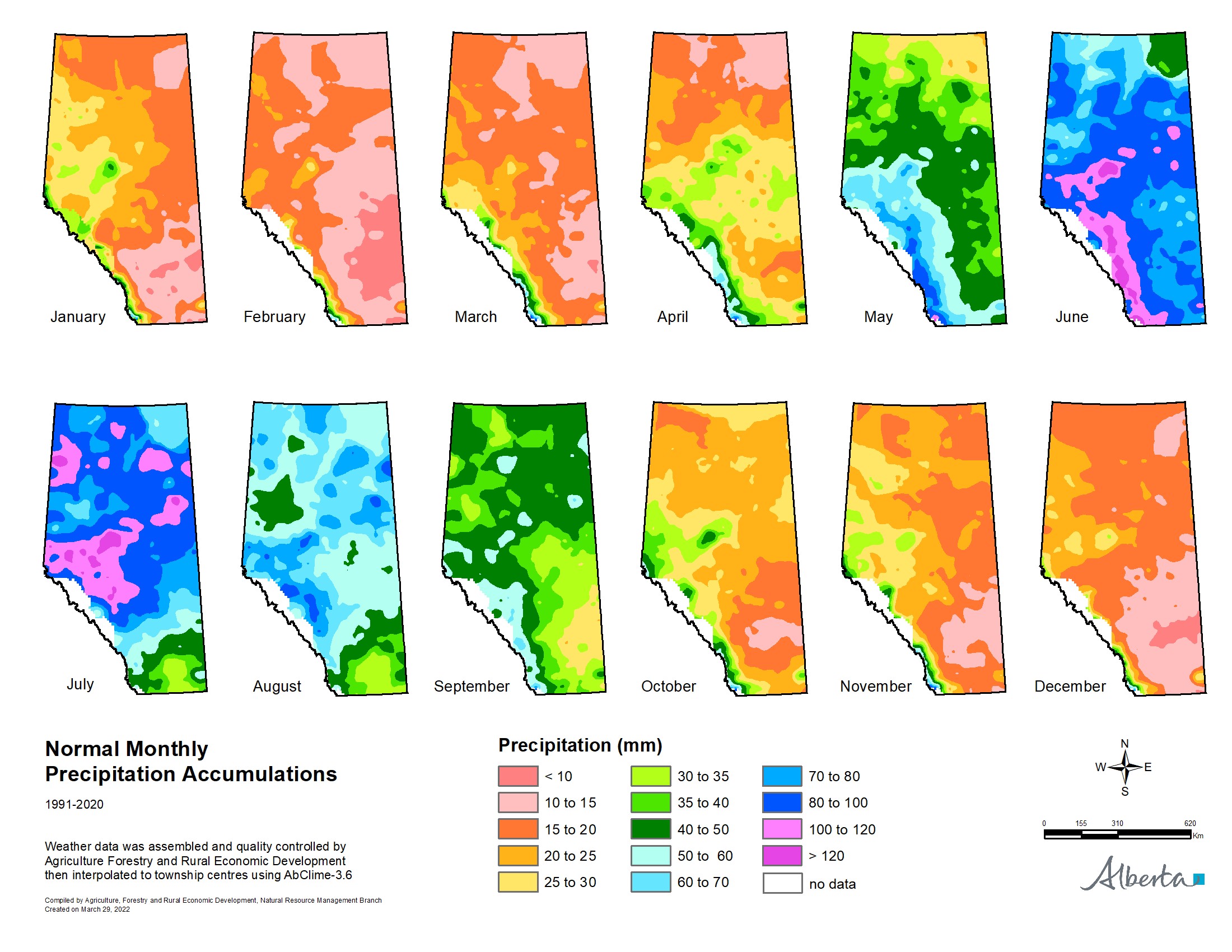
From an annual moisture budget perspective, October through to March generally mark the dry season across the agricultural areas (Map 6), accounting for only about 20% of average annual accumulations across most of the Southern Region, to upwards of 30-35% across the Peace Region. Thus significant moisture deficits thus far (50% of the way through the dry season) while discouraging to many, make up only a small portion of the annual moisture budget for an area. Winter is not over yet, and if the current forecast is correct, a significant cold snap is on its way over the next few days and it is expected to persist well into next week, perhaps even longer. Along with the cold snap, there is also a forecast for moisture and the promise of at least some snow cover across many areas.
Spring is yet many weeks away and anything can happen between now and then. Furthermore, February on average, is the direst month of the year with most agricultural lands normally receiving less than 15 mm of moisture during this month (Map 6). Let’s hope, for the sake of our producers, that we descend into at least near “normal” winter conditions and that we see one of Alberta’s famous weather reversals with respect to moisture. Above average snow fall is very much needed now. Much of the land is extremely dry and has been held tenaciously in the grip of a long lasting dry cycle that needs to end soon.
Sign up to our Newsletter
Stay up to date on the Saddle Hills activities, events, programs and operations by subscribing to our eNewsletters.